UK drainage services
Drain Mapping & Tracing
Find out exactly where your drains run, where they connect and how deep they are. You then get an accurate, shareable drainage plan.
What is a drain mapping & tracing?
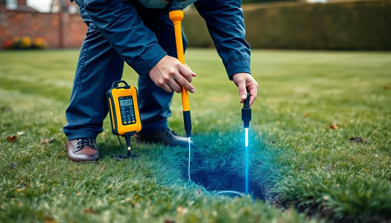
Drain mapping and tracing locates hidden underground pipe runs and confirms where they go. Using a traceable sonde and above-ground detection, we plot the route, depth and connection points and produce an accurate drainage plan.
Drain tracing locates hidden underground pipe runs and confirms where they connect. Because that matters before building work, when connections are unknown, or when a problem cannot be reached, we use camera-mounted sondes and above-ground detection to trace the route and depth.
The result is an accurate drainage map showing pipe runs, chambers, flow direction and connection points. As a result, builders and planners know exactly what lies underground before work starts.
When you need a drain mapping & tracing
- You are planning an extension, new build or major landscaping
- You do not know where your drains run or what they connect to
- You need a build-over or build-near sewer agreement
- There is a question over shared drainage responsibility
- A pipe needs work but cannot be located from the surface
Why it matters
Know what is underground
You avoid striking drains during extensions, landscaping or excavation. Because we mark the route on site, everyone knows where not to dig.
Confirm connections
We establish whether drainage connects to the public sewer, a soakaway or a private system. This matters for build-over agreements and shared-drainage questions alike.
Accurate plans
You get a clear map for builders, architects, surveyors or planning. As a result, quotes and applications rest on fact rather than guesswork.
What's included
- Tracing of the pipe route, marked out on site
- Depth and position of pipe runs and connection points
- Confirmation of flow direction and what each run connects to
- A clear drainage plan you can share with builders or planning
How it works
- 01
Insert sonde
First, a traceable sonde travels the pipe while we follow its signal from the surface. Because the signal is precise, we pinpoint the route without any digging.
- 02
Trace route & depth
Next, we mark the run, its depth and the connection points above ground. Meanwhile, we note anything that could affect your planned work.
- 03
Produce the map
Finally, we draw the findings up into a clear drainage plan. You can then share it with builders, architects or the local authority.
How much does a drain mapping & tracing cost?
The cost of drain tracing and mapping depends on the size of the site and how many runs need tracing. Larger sites, or a trace combined with a full CCTV survey, are quoted on scope — send us the details and we will give you a clear, fixed-price quote.
What affects the price
- The size of the site and number of runs to trace
- Depth and accessibility of the pipework
- Whether you need a formal drainage plan for planning
- Whether a full CCTV survey is carried out at the same time
Because we quote every job on its specifics, send us the details and we will give you a firm, no-obligation, fixed-price figure. Get a free, no-obligation quote →
Drain Mapping & Tracing — your questions answered
How much does drain tracing cost?
It depends on the size of the site and how many runs need tracing. On a larger site, or combined with a CCTV survey, we quote on scope, so send us the details for a fixed-price quote.
Why would I need drain tracing?
Most often before an extension or new build, to confirm connections, resolve shared-drainage questions, or locate a pipe that cannot otherwise be reached. Because the route is unknown in these cases, a trace saves both guesswork and damage.
Can you confirm if my drain connects to the public sewer?
Yes. Because tracing establishes where a run goes and what it connects to, it gives you exactly the evidence a build-over agreement needs.
Do I need this for a build-over agreement?
Often, yes. Water companies usually want to know the position and depth of any public sewer near your build, and a trace provides precisely that.
Related services
Get a drain mapping & tracing quote
Tell us what you need and where you are, and we will come back with a clear price and the earliest available appointment. Because we quote every job individually, you only pay for the work your drains actually need.